3.1.3.6 - A contrasting coast beyond the UK
Use Delfland and the Sand Motor in the Netherlands to contrast an engineered sandy dune coast with Holderness. Evaluate risks, opportunities and resilience by separating intervention aims from monitored outcomes.
Delfland and the Sand Motor
The Delfland coast faces the North Sea between Hoek van Holland and Scheveningen, with sandy beaches and dunes protecting the land behind.
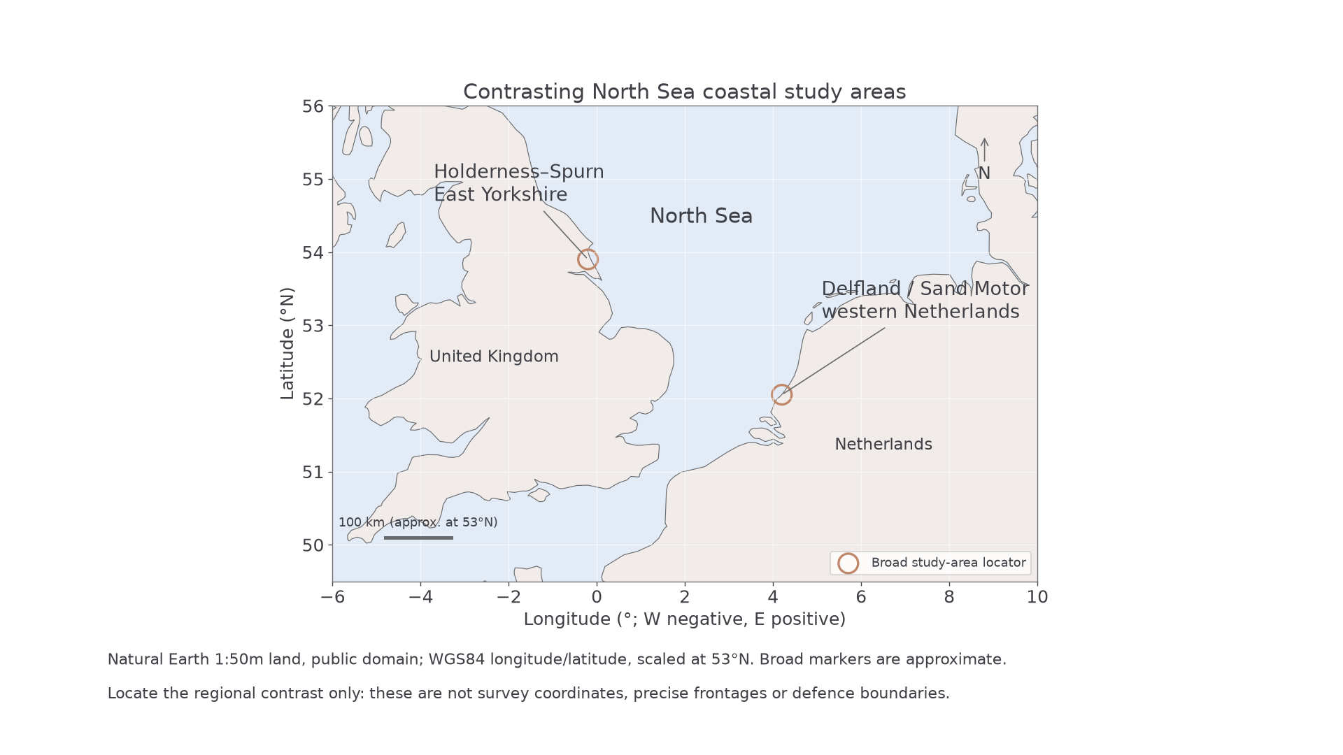
The locator uses broad study-area markers, not survey points or defence boundaries. Geographic position is controlled by the map data rather than generated decoration.
Rijkswaterstaat records that the Sand Motor was constructed in 2011 near Ter Heijde and Kijkduin using 21.5 million m³ of sand. Its initial peninsula occupied about 128 ha. This is a deliberately added sediment store, not a natural delta formed by river deposition. Waves, currents and wind redistribute the sand, supplying neighbouring coastal stores and changing the original shape. Lagoons, a dune lake and new exposed surfaces affect how water and wind move material.
Contrast the mechanisms. Holderness supplies mixed-size sediment through retreat of unconsolidated till cliffs; sand/gravel and suspended fines follow different pathways towards beaches, offshore areas and Spurn. Delfland's intervention deliberately supplies a large sandy input to an existing beach/dune system. Both are open, changing systems, but their geology, stores and management choices differ. A Dutch dune-volume change cannot be directly compared numerically with an English cliff-recession rate because the variables and units differ.
The landforms also have a history before the intervention. The 2021 evaluation notes dune reinforcement in 2010. A later broad beach or dune buffer should not all be attributed to the Sand Motor without considering that earlier work. Coastal evidence needs a baseline, not only a photograph after construction.
Risks and development opportunities
A dune-backed coast can support occupation and recreation while remaining exposed to flooding and landscape change.
Storm waves, surge and high tide can erode beaches and dunes or produce overtopping. A sandy buffer dissipates energy and provides material for recovery, but it can be depleted or redistributed. Sea-level rise raises the baseline for extreme water, and future sediment requirements may change. The value of protected settlements, access and economic uses increases the consequences of failure; a defended appearance does not mean zero residual risk.
The Sand Motor's stated objectives included coastal maintenance/safety support, nature, recreation and learning through innovation. A wider sandy area offers space for recreation and potential habitat development, while research creates knowledge that can inform other coasts. These are opportunities, not automatic measured benefits for every user or organism. Changing lagoon and beach morphology can also alter access, water conditions and habitat, requiring monitoring and user management.
Opportunity and risk are linked. Encouraging more fixed development because a temporary sand buffer looks secure could increase future exposure. Retaining room for dunes and beaches to move can preserve adjustment capacity, but limits how land is used. Compare not only protective performance but the distribution of costs and benefits among coastal users and institutions.
Against Holderness, Delfland illustrates active sediment addition and a dune defence setting rather than relying on continued cliff retreat as a sediment source. That contrast supports analysis of mitigation: reducing hazard impact through buffers. Adaptation also includes changing uses, access and maintenance as the coast evolves; neither approach removes all uncertainty.
Continue this lesson.
You’re previewing NovaLearn without an account. Create a free account to read the rest.
Create free account