2B.9 - Coastal flooding and future risk
Learn how local coastal conditions amplify flooding, how storm surges form, and how to interpret climate projections while allowing for uncertain futures.
Low land and local change amplify flooding
Flood hazard becomes damaging risk where high water intersects people, infrastructure and vulnerable livelihoods. Low-lying land has little vertical clearance above sea level; estuaries can transmit high sea levels inland and prevent rivers or drainage channels from discharging. Subsidence reduces clearance further. Sediment deposition may build land, but embankments can exclude the floods which formerly deposited sediment, leaving enclosed surfaces low relative to surrounding channels.
Removing dunes, salt marsh or mangroves can reduce friction, wave-energy dissipation and sediment trapping. Vegetation is useful protection, but its effect depends on width, density, species and water depth; it cannot guarantee safety against every surge. Drainage maintenance and the condition of embankments also matter.
Coastal Bangladesh combines a low delta surface, subsidence and cyclone exposure around the Bay of Bengal. The World Bank's August 2022 coastal-project account describes low-lying polders enclosed by embankments and the need to improve protection against tidal flooding and saline intrusion. Its reported works included 249 km of upgraded embankments by December 2021. This is dated project evidence, not proof that all Bangladesh is protected or that every flood there is coastal.
Weather raises water above the predicted tide
A storm can raise coastal water above the tide predicted from the gravitational effects of the Moon and Sun.
Storm surge
The abnormal rise in sea level generated by a storm above the predicted astronomical tide. The resulting tide plus surge is the storm tide; waves can add further run-up.
Strong onshore winds transfer momentum to the sea and pile water against the coast. Low air pressure also allows water level to rise, but wind is usually the principal driver of tropical-cyclone surge. NOAA's storm-surge explanation shows why a wide, shallow shelf permits a larger surge than a steep, deep shelf. Coastline shape, storm track, speed and intensity influence where the greatest rise occurs. Estuarine funnels can concentrate water.
Both tropical cyclones and mid-latitude depressions can produce surges. Flooding is especially severe when surge coincides with high astronomical tide and waves. In an original simplified example, a predicted tide of 2.2 m above a stated datum plus a 1.0 m surge gives 3.2 m still-water storm tide; wave run-up is additional. The components can interact, so operational forecasts use hydrodynamic models rather than assuming exact simple addition everywhere.
During the 5–6 December 2013 UK surge, low pressure, strong winds and high tides combined. A 10 December 2013 parliamentary statement reported about 1,400 flooded properties. A developed economy therefore retains residual coastal risk despite warnings and defences.
Higher baseline, changing storms and uncertainty
Sea-level rise raises the baseline from which tides, surges and waves act. An extreme level can exceed a fixed defence more frequently even if the storms themselves do not become more frequent. Warming also supports heavier rainfall and more intense tropical cyclones, increasing compound flooding when rain, river flow and coastal water obstruct drainage together. Do not claim that the number of every kind of storm increases everywhere: changes in tracks, regional frequency and intensity differ and remain uncertain.
The IPCC AR6 2021 Summary for Policymakers, B.5.3 gives likely global mean sea-level rise by 2100 relative to 1995–2014. The graph compares very low and very high emissions pathways; the endpoints are ranges, not annual rates or guaranteed limits.
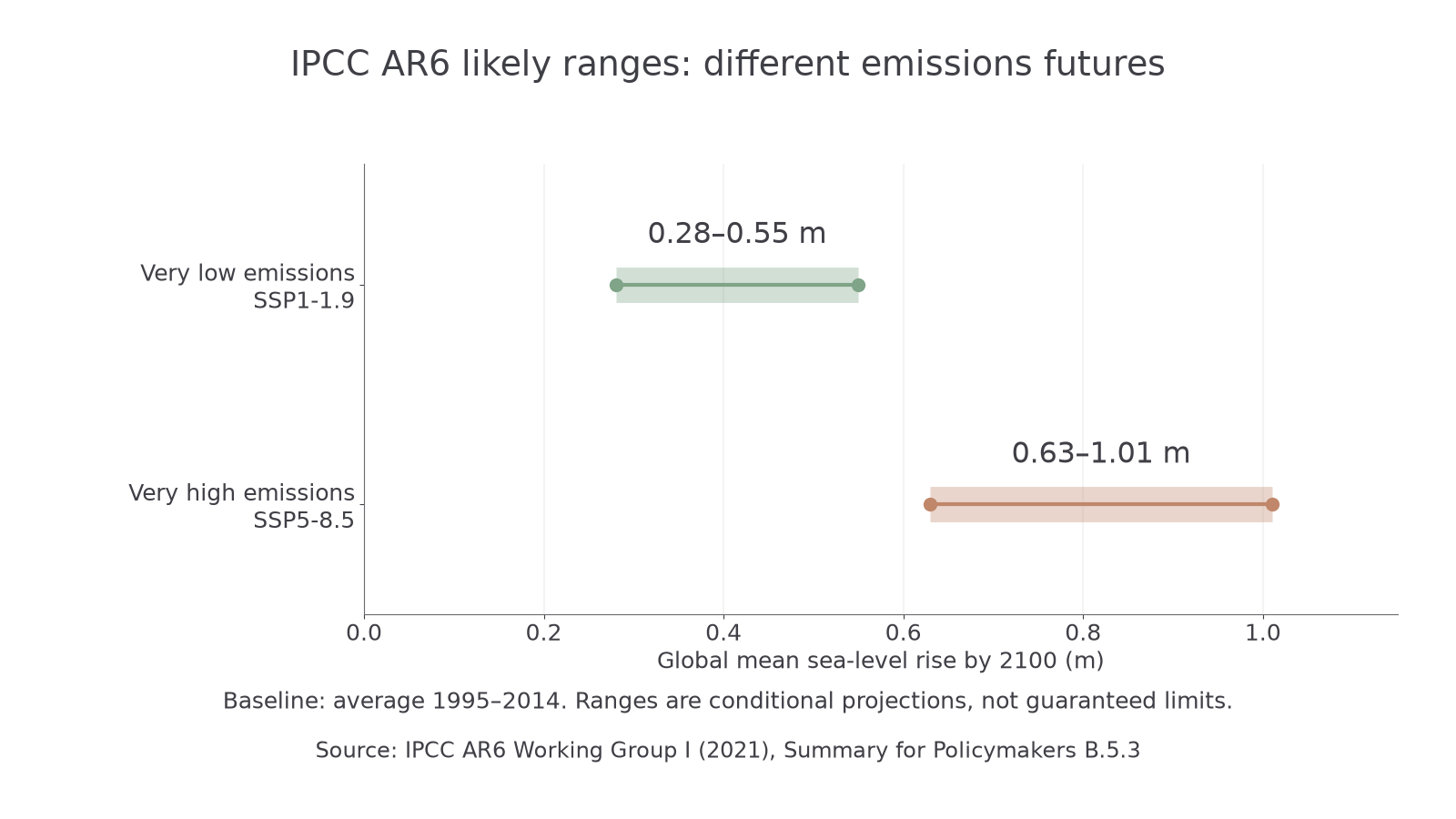
Authentic IPCC AR6 ranges: SSP1-1.9, 0.28–0.55 m; SSP5-8.5, 0.63–1.01 m. Baseline 1995–2014; projection year 2100.
Uncertainty comes from future emissions, ocean response, ice-sheet behaviour and local uplift or subsidence. These global ranges cannot be applied unchanged to one village. Nor should the upper likely value be treated as the maximum physically possible rise: lower-likelihood ice-sheet outcomes matter for high-consequence infrastructure. Exposure also changes as settlements expand or relocate.
Uncertain magnitude does not mean uncertain direction of global rise. Compare scenarios and consequences, monitor local conditions and choose measures which can be adjusted as evidence changes.
Act on causes and consequences
Mitigation reduces the climate driver through cutting greenhouse-gas emissions or increasing removals. Adaptation reduces harm from the coastal changes already occurring or expected: raising or moving assets, maintaining defences, restoring habitats, warning and evacuation, or restricting development on exposed land. Coastal engineering is primarily adaptation; it does not itself stop global sea-level rise.
Because ocean warming and ice-sheet change respond slowly, adaptation is needed even if emissions fall. An adaptive pathway sets monitored triggers—for example a measured water level or unacceptable flood frequency—at which protection is upgraded or relocation begins. This avoids pretending to know an exact date of failure, but it requires finance, land, early preparation and fair consultation. Waiting until damage occurs may leave no practical route for people with little money to move.